


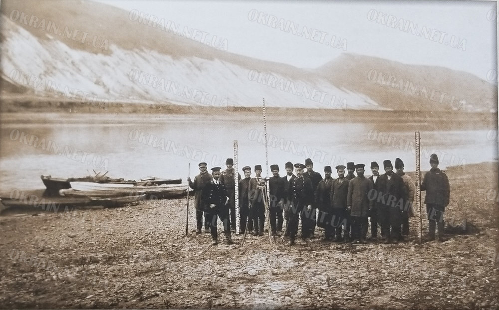

At the beginning of the 20th century, regular survey work was carried out on the Middle Dnieper in order to improve the conditions of navigation, for which geodetic surveys of the coastal sections of the river were carried out, as a result of which maps and plans of different sections of the Dnieper were drawn up and photographic fixation of the Dnieper was carried out.
Date: 1903
Location: The Dnieper River near Pivikha Mountain
Album “To the project of improving the navigable conditions of the Dnieper River. Gradizhsk-Ekaterinoslav”
Source: The book “Kremenchug: Beloved City” documentary-fiction edition 2019


Натисніть, щоб скопіювати адресу:
Відскануйте QR-код гаманцем Trust Wallet, TronLink або через біржу.
Інформація для правовласників:
Ми з великою повагою ставимося до авторських прав. Якщо ви є автором опублікованого фото чи тексту і не бажаєте, щоб вони залишалися на цьому ресурсі, або маєте зауваження щодо авторства — будь ласка,
зв’яжіться з нами.
Ми оперативно розглянемо звернення.